 Gabriel X. Michael
February 4, 2015
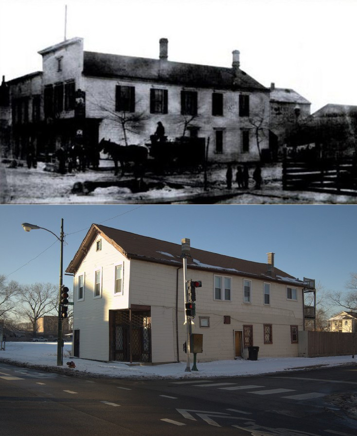
4200 W. Lake Street: formerly the Best Beer tied house/tavern circa 1883 (top image: p. 49, Lost German Chicago, Arcadia Publishing), currently a residential building. (bottom image by Gabriel X. Michael/Chicago Patterns)
Built in 1883, the two-story frame building at 4200 West Lake Street has undergone several transformations, just like the surrounding West Garfield Park community area. Pre-dating the Lake Street Elevated Railroad (now the CTA Green Line Lake Branch), it originally served as a “tied house” or tavern controlled by the Milwaukee-based Best Beer Brewing Company.
Continue reading »
Gabriel X. Michael
October 3, 2014
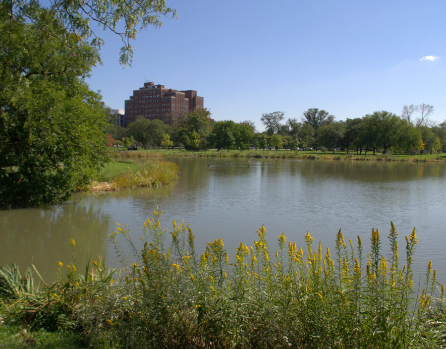
Gabriel X. Michael/Chicago Patterns
Douglas Park is one of Chicago’s most scenic city parks in the heart of the west side of Chicago. Spread across 174 acres in the North Lawndale community area, it is located between West Roosevelt Road and West 19th Street to the north and south (respectively), and South California Avenue and South Albany Avenue to the east and west.
Established in 1869 as the southern park of the West Park System, along with Humboldt (formerly “North”) and Garfield (formerly “Central”) Parks, the park exhibits the design talents of multiple renowned architects including William LeBaron Jenney, Oscar F. Dubuis, and Jens Jensen, along with locally-notable designers Michaelsen & Rognstad.
Continue reading »
Gabriel X. Michael
September 3, 2014

Gabriel X. Michael/Chicago Patterns
Before Edward Brennan developed the comprehensive 8 blocks-to-a-mile address system in 1909, Chicago street addresses were disorganized and confusing, being based on three distinct divisions of the city created by its surrounding waterways of the Chicago River, its branches, and Lake Michigan. Lake Street (the first street platted in the village of Chicago) was the city’s original dividing line between north and south but east and west designations depended on which side of the Chicago River and Lake Michigan you were located. Continue reading »
Gabriel X. Michael
August 5, 2014
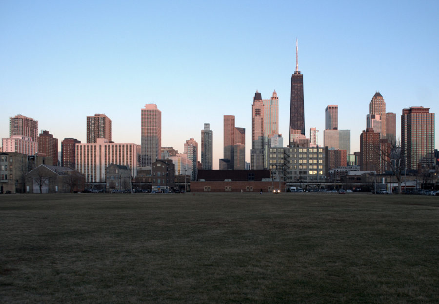
Viewing east towards the Near North skyline from 900 block of Hudson Avenue. Vacant former site of Cabrini Extension South high-rises in foreground. Gabriel X. Michael/Chicago Patterns
Located just north of downtown and on the eastern side of Chicago’s man-made Goose Island and North Branch Canal, the Lower Near North Side has been called many names, and served as home to Chicago’s poor working class and multi-ethnic waves of immigrants.
It was notably put under a microscope by urban sociologist Harvey Warren Zorbaugh in his highly-influential and precedential book The Gold Coast and the Slum (1929), where he chronicled its notorious living conditions, detailed its socio-economic makeup, and elucidated tangled patterns of dysfunction sustaining this “slum’s” existence, blocks from one of Chicago’s wealthiest communities to the east. Central to his philosophy was the idea of “natural areas” within a city–the unplanned, organic enclaves that emerge out of a coincidence of physical geography and cultural segregration: the Lower Near North Side being a prime example of this urban phenomena.
Continue reading »
