The Other Side of Old Town: Remnants of Swede Town and Little Sicily

Viewing east towards the Near North skyline from 900 block of Hudson Avenue. Vacant former site of Cabrini Extension South high-rises in foreground. Gabriel X. Michael/Chicago Patterns
Located just north of downtown and on the eastern side of Chicago’s man-made Goose Island and North Branch Canal, the Lower Near North Side has been called many names, and served as home to Chicago’s poor working class and multi-ethnic waves of immigrants.
It was notably put under a microscope by urban sociologist Harvey Warren Zorbaugh in his highly-influential and precedential book The Gold Coast and the Slum (1929), where he chronicled its notorious living conditions, detailed its socio-economic makeup, and elucidated tangled patterns of dysfunction sustaining this “slum’s” existence, blocks from one of Chicago’s wealthiest communities to the east. Central to his philosophy was the idea of “natural areas” within a city–the unplanned, organic enclaves that emerge out of a coincidence of physical geography and cultural segregration: the Lower Near North Side being a prime example of this urban phenomena.

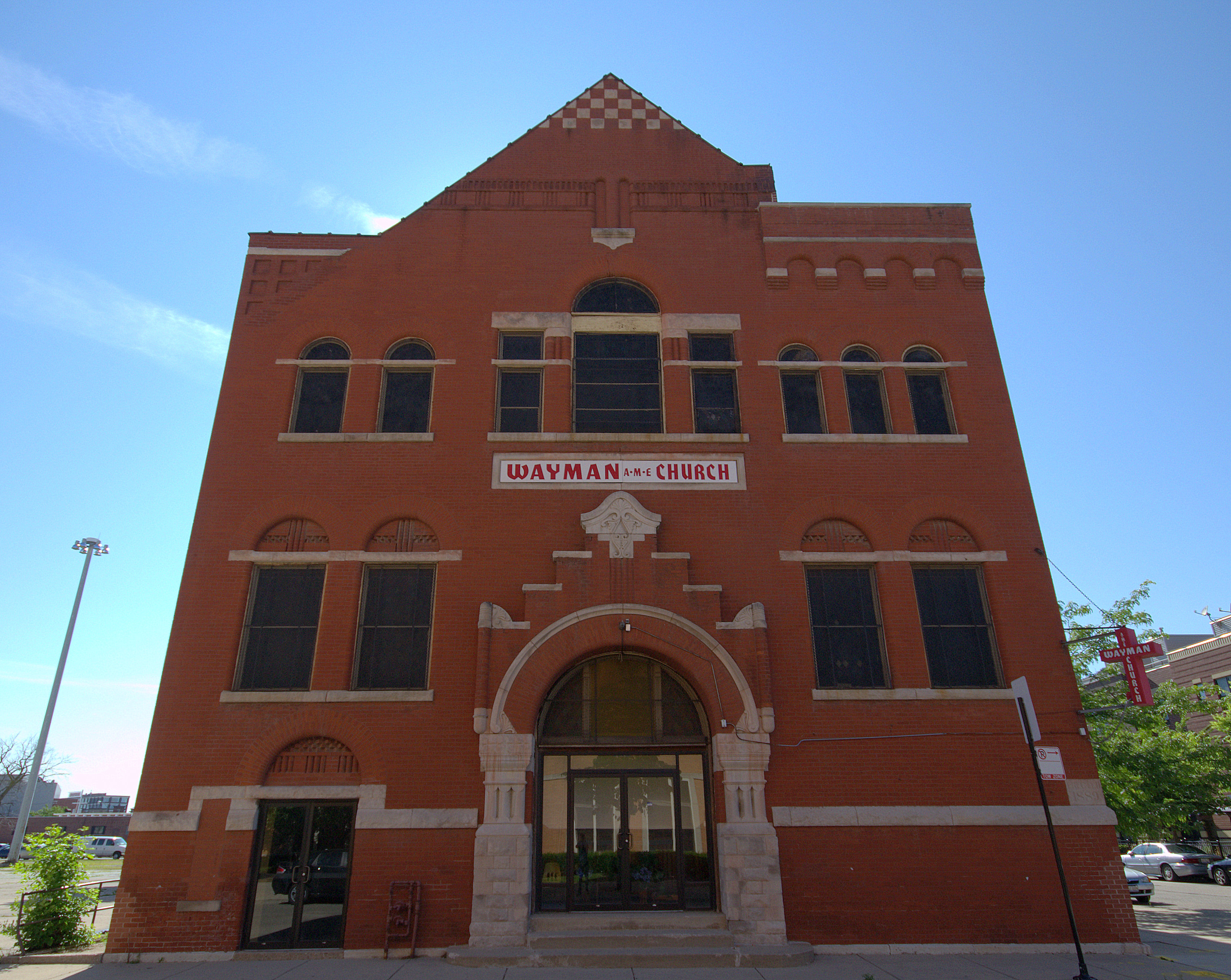
North facade of the former First Swedish Baptist Church, built 1889; now Wayman AME at Elm and Cleveland. Gabriel X. Michael/Chicago Patterns
“Little Hell”
Beginning in the 1840s, this area was first occupied by German immigrants when it was on the edge of Chicago and provided cheap, accessible land for both home and farm. Irish immigrants displaced by the Great Potato Famine replaced the Germans who had achieved the means to move on to more “desirable” neighborhoods. The neighborhood was known by many titles, maybe the most infamous is “Little Hell,” due to the overwhelming stench and sight of People’s Gas Light & Coke Co. plant on the riverbank.
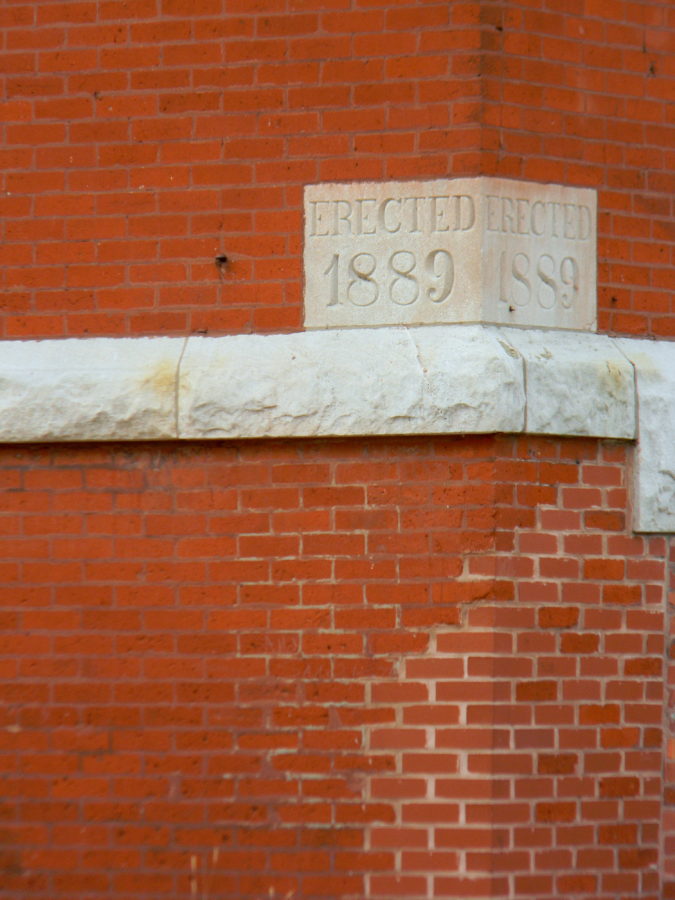
Detail of 1889 cornerstone for former First Swedish Baptist Church, now Wayman AME Church, at 509 West Elm Street. Gabriel X. Michael/Chicago Patterns
As more industries and plants such as lumberyards and tanneries were constructed along the banks of Goose Island to the west, the area became populated with Swedish immigrants, whose numbers in the area exploded after the Great Chicago Fire in 1871.
East facade of former First Swedish Baptist Church on Cleveland Avenue, built 1889, now Wayman AME Church. Gabriel X. Michael/Chicago Patterns
One remaining artifact from their settlement is the former First Swedish Baptist Church building at Cleveland and Elm. Built in 1889, it is currently the Wayman AME Church.
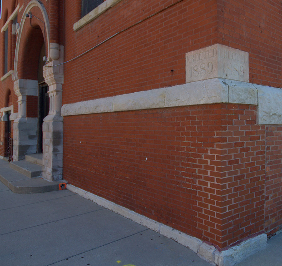
View of the northeast corner of former First Swedish Baptist Church, now Wayman AME, at 509 West Elm Street. Gabriel X. Michael/Chicago Patterns
Visions of the “Old Neighborhood”
The square quarter-mile of Division and Oak Streets on the north and south, and Larrabee and Orleans Streets on the west and east, was once criss-crossed by neighborhood thru-streets which were completely saturated with low-quality residential housing, usually multiple buildings on one lot as seen in the 1906 Sanborn Fire Insurance map details below.

Detail of 1906 Sanborn Fire Insurance map showing the area from Oak (1000N) and Locust (900N), and Larrabee (600W) to Townsend, now Sedgwick (400W).
Hastily-built wooden tenements and workers’ cottages were the predominant style since this area was just outside the boundaries prohibiting wood framing, enacted by new fire codes after the Great Chicago Fire of 1871.
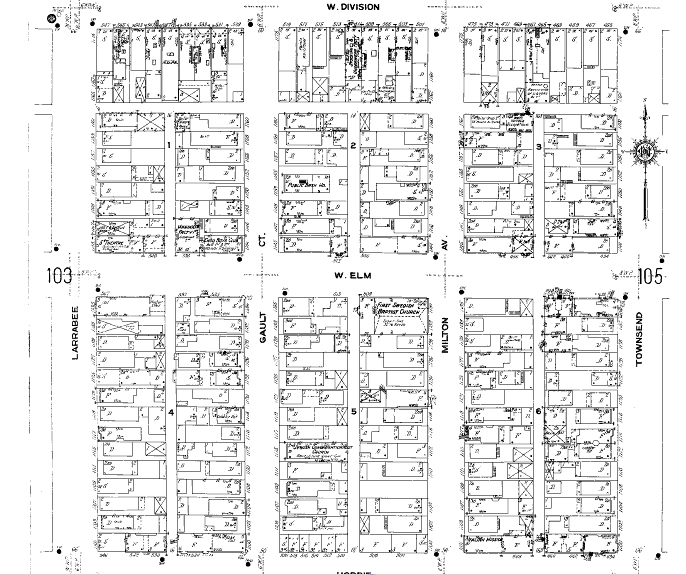
Detail from 1906 Sanborn Fire Insurance map showing the area from Division (1200N) to Hobbie (1032N), and Larrabee (600W) to Townsend, now Sedgwick (400W). Note the First Swedish Baptist Church at Elm and Milton, now Cleveland Avenue.

Exposed streetcar rails for Chicago Surface Lines at former Sedgwick Avenue right-of-way north of Wendell Street. These date to 1895 when streetcar service transitioned to electric power, and served as the southbound tracks on the #37 route. Gabriel X. Michael/Chicago Patterns
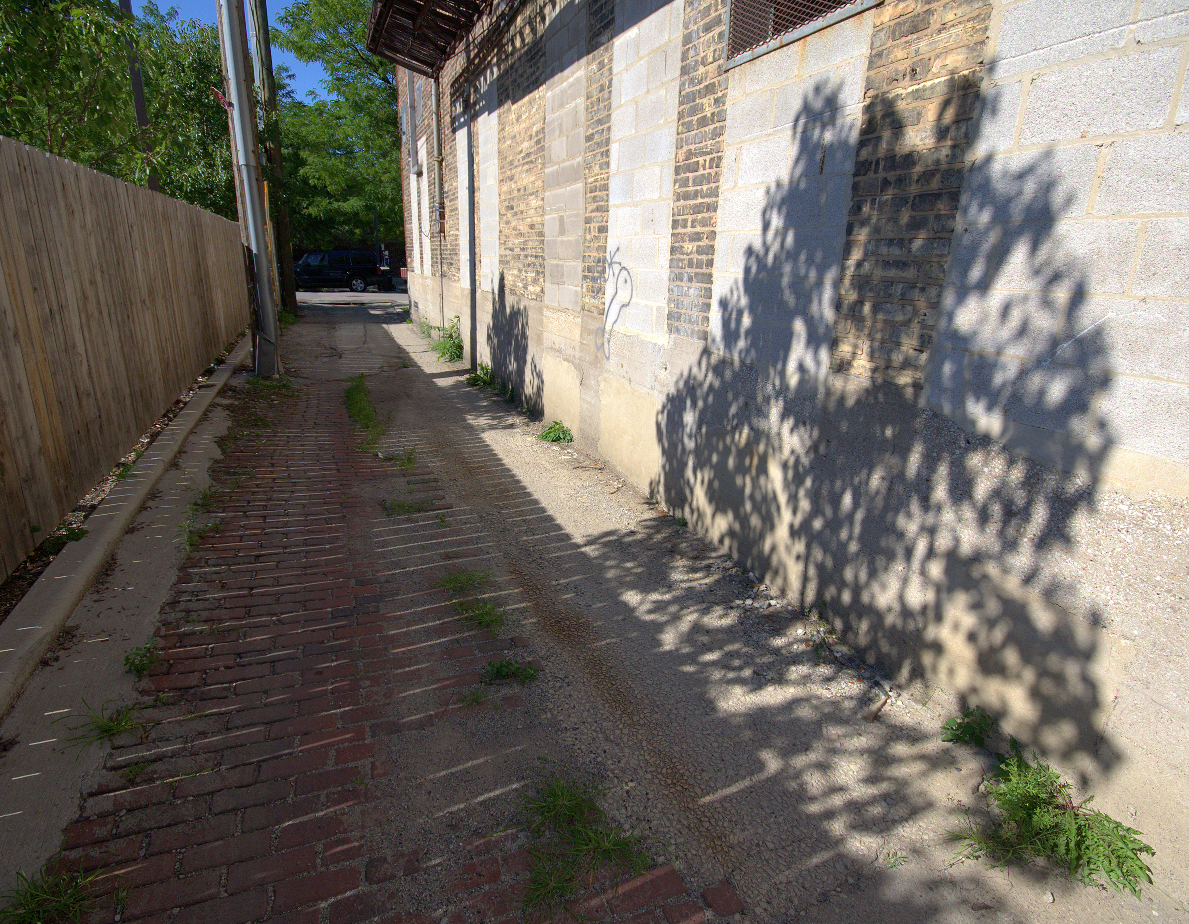
View of a brick paved alley behind the former Fire Insurance Patrol station at 1044 North Orleans Street, now Chicago Fire Department Support Services #1. Gabriel X. Michael/Chicago Patterns
After the Chicago Housing Authority successfully established the two-story Francis Cabrini Rowhomes in 1942, what infrastructure was left of this old neighborhood and its residences was leveled to build a second development of public housing: the “Cabrini Extension” modernist mid- and high-rises completed in 1958.
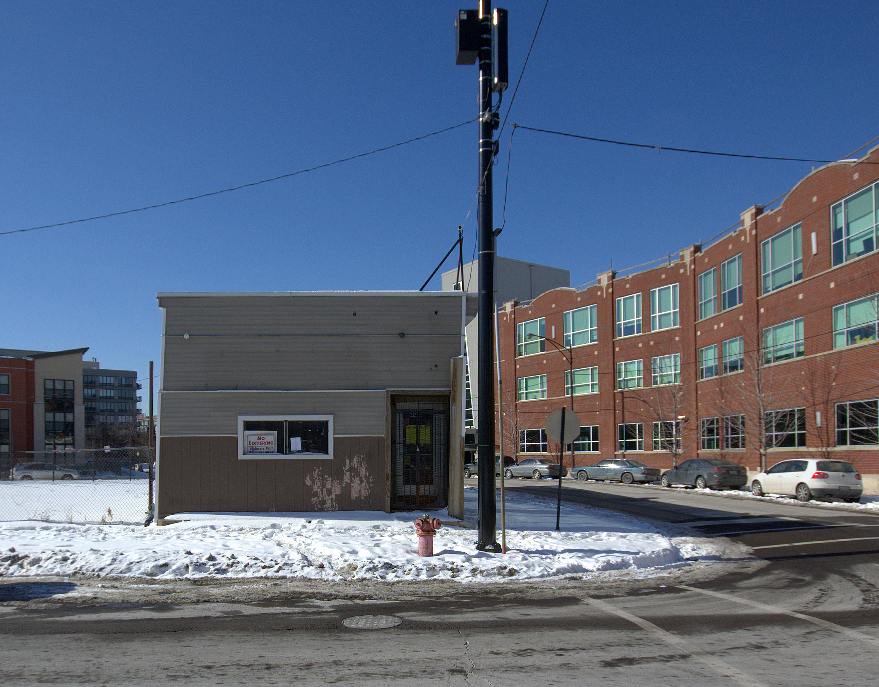
Front view of 956 North Larrabee Street, built 1874 (February 2014). Gabriel X. Michael/Chicago Patterns
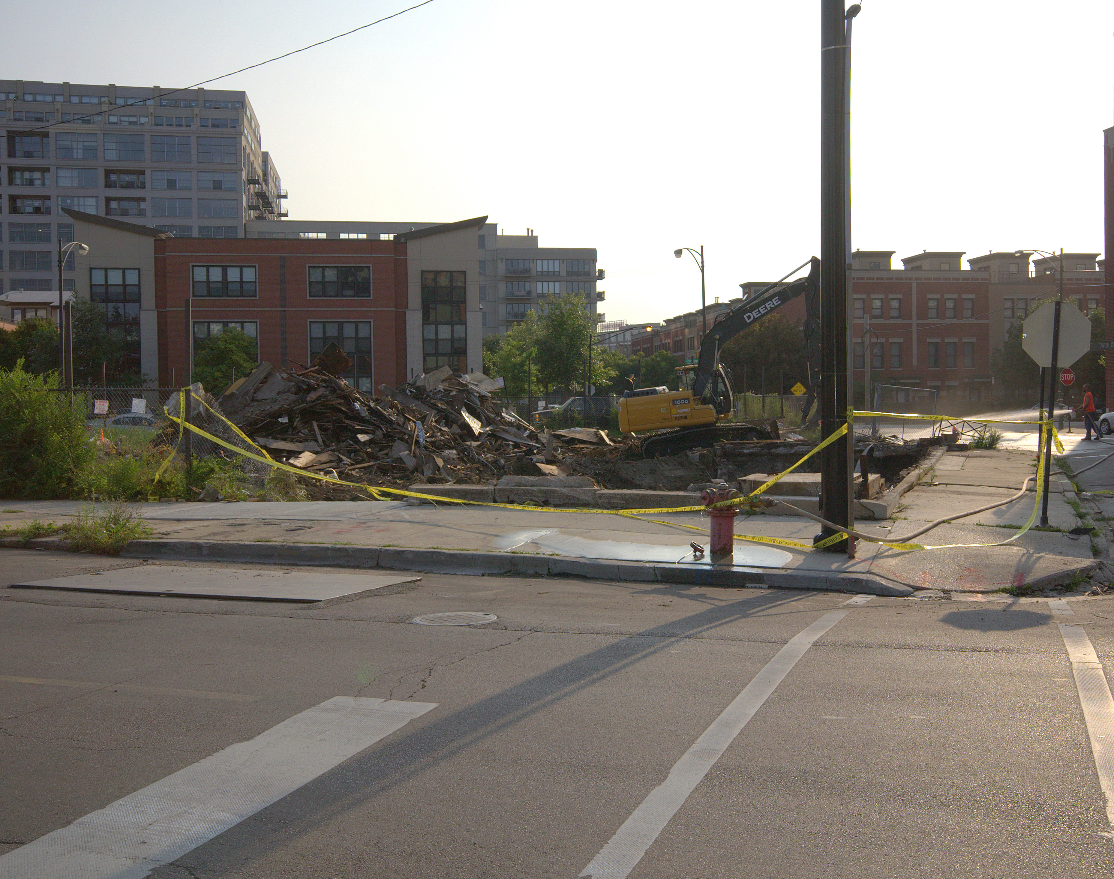
Demolition of storefront building at 956 North Larrabee Street, built 1874 (August 2014). Gabriel X. Michael/Chicago Patterns
Little Sicily
Around 1900, the area population shifted again, and it became the place of “first settlement” for many Sicilian and Italian immigrants, developing into “Little Sicily” as the former Central European community began moving further north and west of the city center.
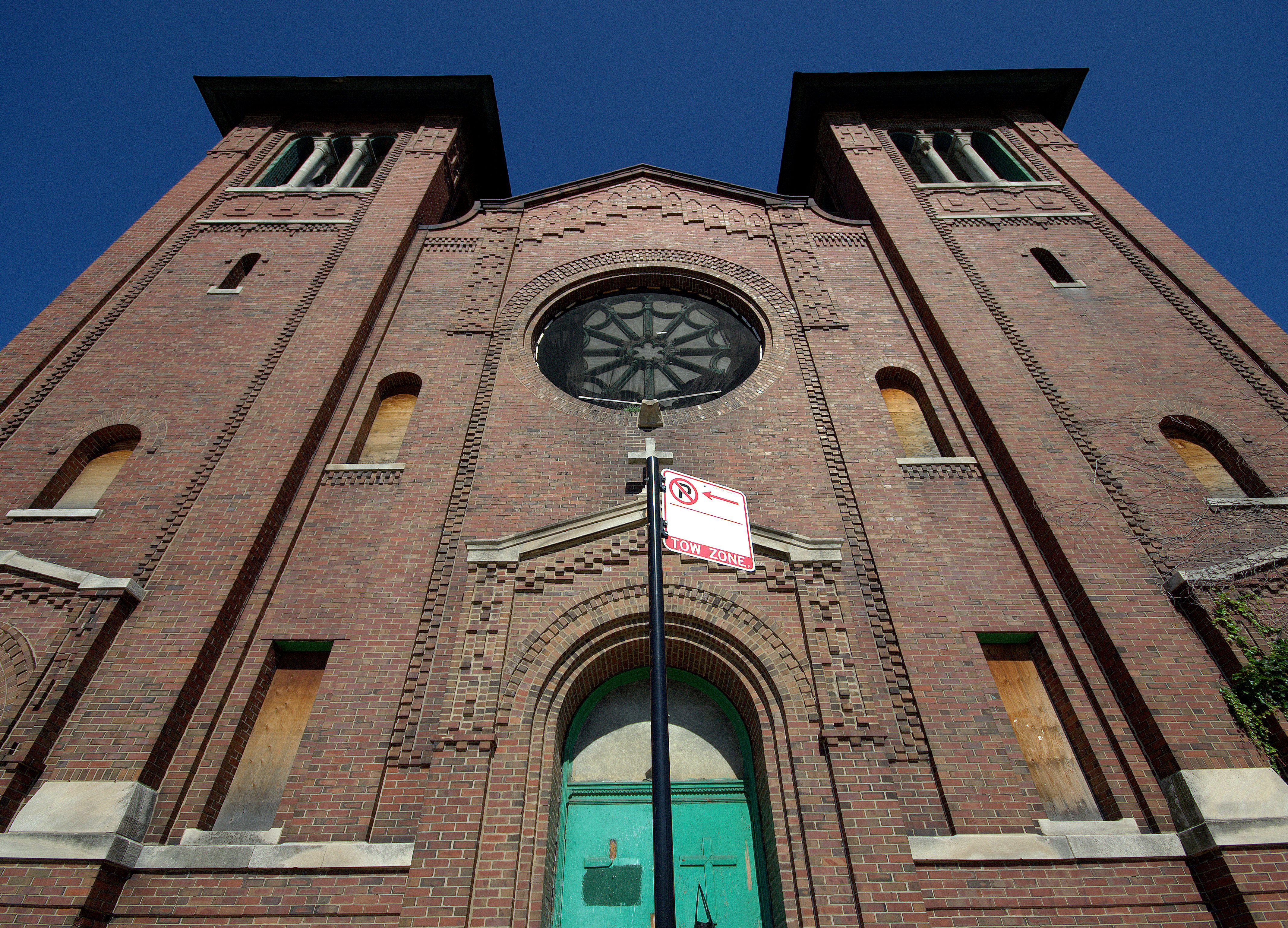
West facade and front entrance of Saint Dominic’s Catholic Church, built 1905. Gabriel X. Michael/Chicago Patterns
One remaining and beautiful structure from that era is Saint Dominic’s Catholic Church at 357 West Locust Street.
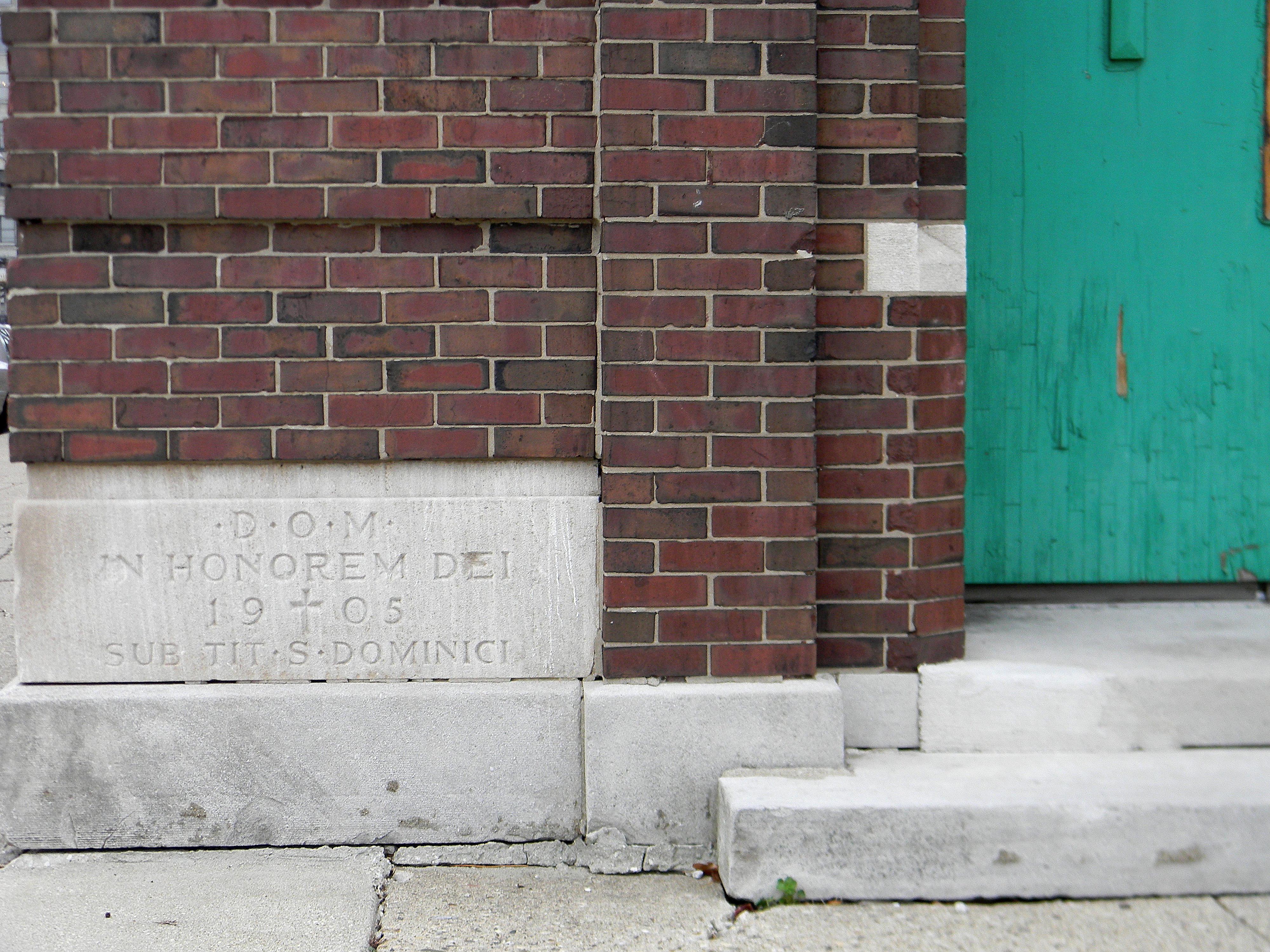
View of 1905 cornerstone for Saint Dominic’s Catholic Church at 357 West Locust Street. Gabriel X. Michael/Chicago Patterns
Vacant and disused since it last held services in 1990, this building is now on the waiting list for its demolition, to be replaced with plans for a 40-unit condo development as another part of the area’s rapid redevelopment within the past few years.
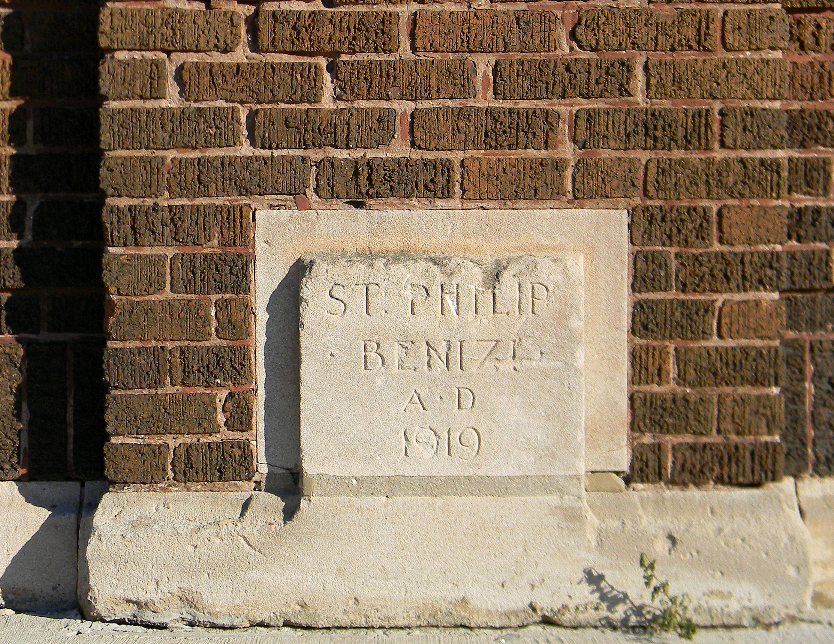
Cornerstone for former Saint Philip Benizi School at 515 West Oak Street, built 1919. Gabriel X. Michael/Chicago Patterns
Another important part of the area’s former Sicilian community was the Saint Philip Benizi Church at 988 North Cambridge.
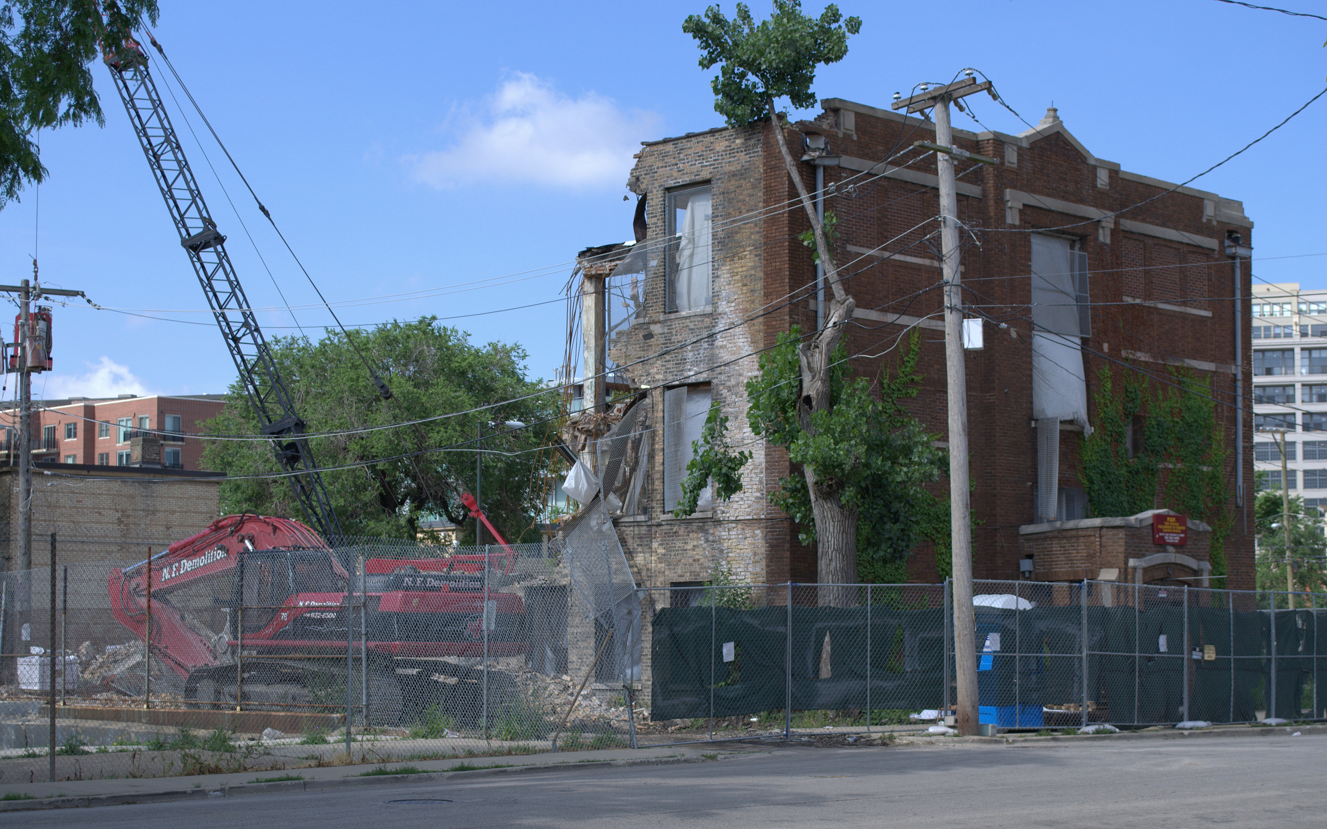
Demolition of former Saint Philip Benizi School at 515 West Oak Street, built 1919 (June 2012). Gabriel X. Michael/Chicago Patterns
The adjoining school of Saint Philip Benizi Church at 515 West Oak Street, with 1000 children at one time enrolled across the Sunday, nursery, and primary school services offered there, was demolished in June 2012.
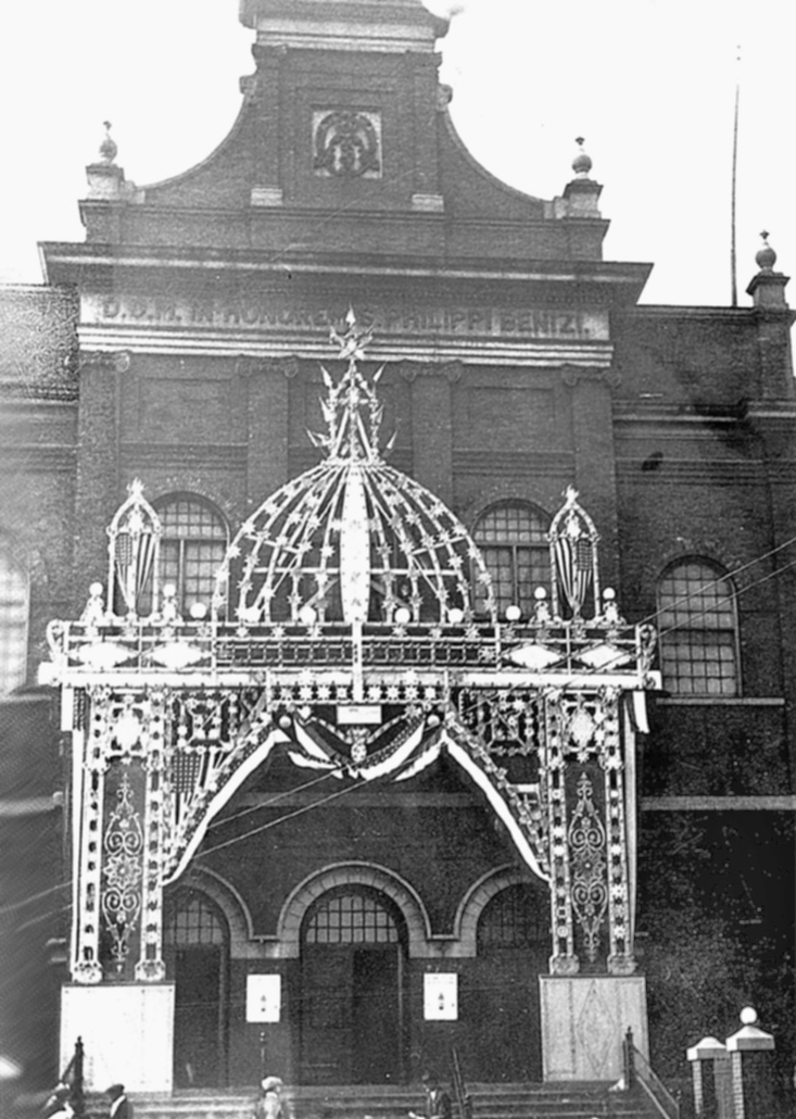
Facade of Saint Philip Benizi Catholic Church at 988 North Cambridge Avenue, date unknown. Calogero Lombardo/Gabriel X. Michael/Chicago Patterns
Built in 1919, this school served the Saint Philip Benizi Catholic Church to the south, which was demolished approximately 1965.
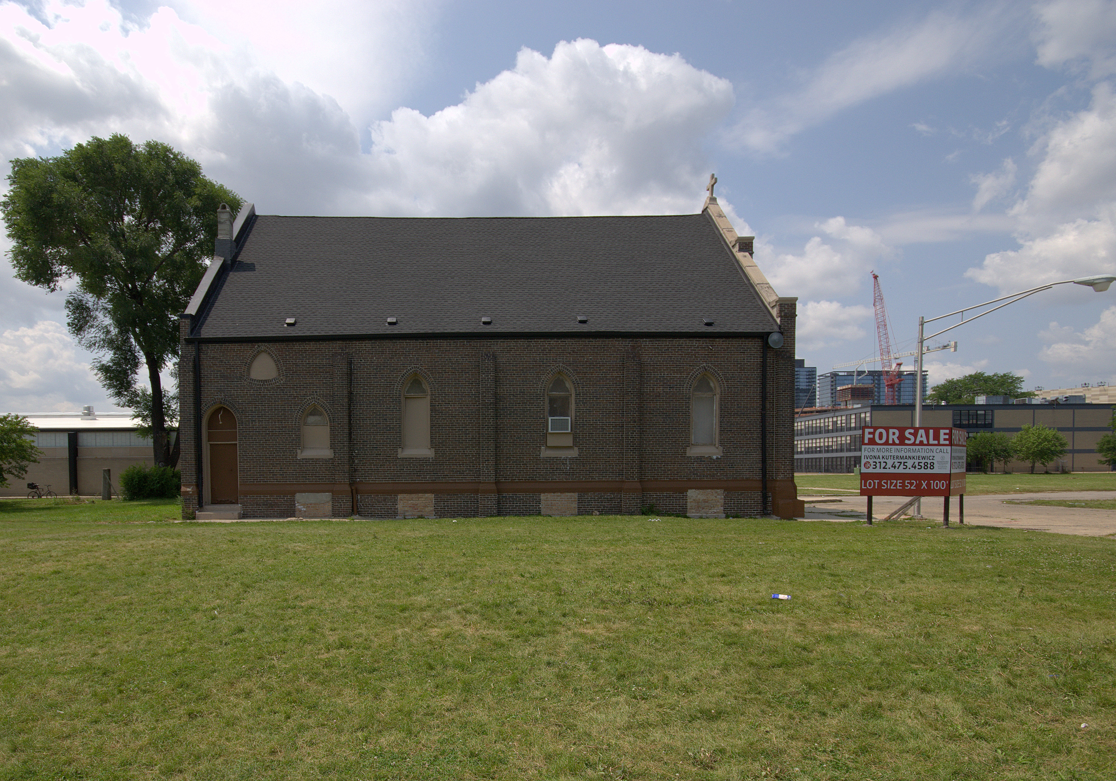
View of east facade of former San Marcello Mission, now Strangers’ Home MB Church and for sale. Gabriel X. Michael/Chicago Patterns
North of Division Street, few remnants of the historic communities exist except for some late-19th Century Italianate storefront-with-flats buildings on the 1200-1300 block of North Clybourn Avenue, and a church surrounded by open land at 617 West Evergreen Avenue.
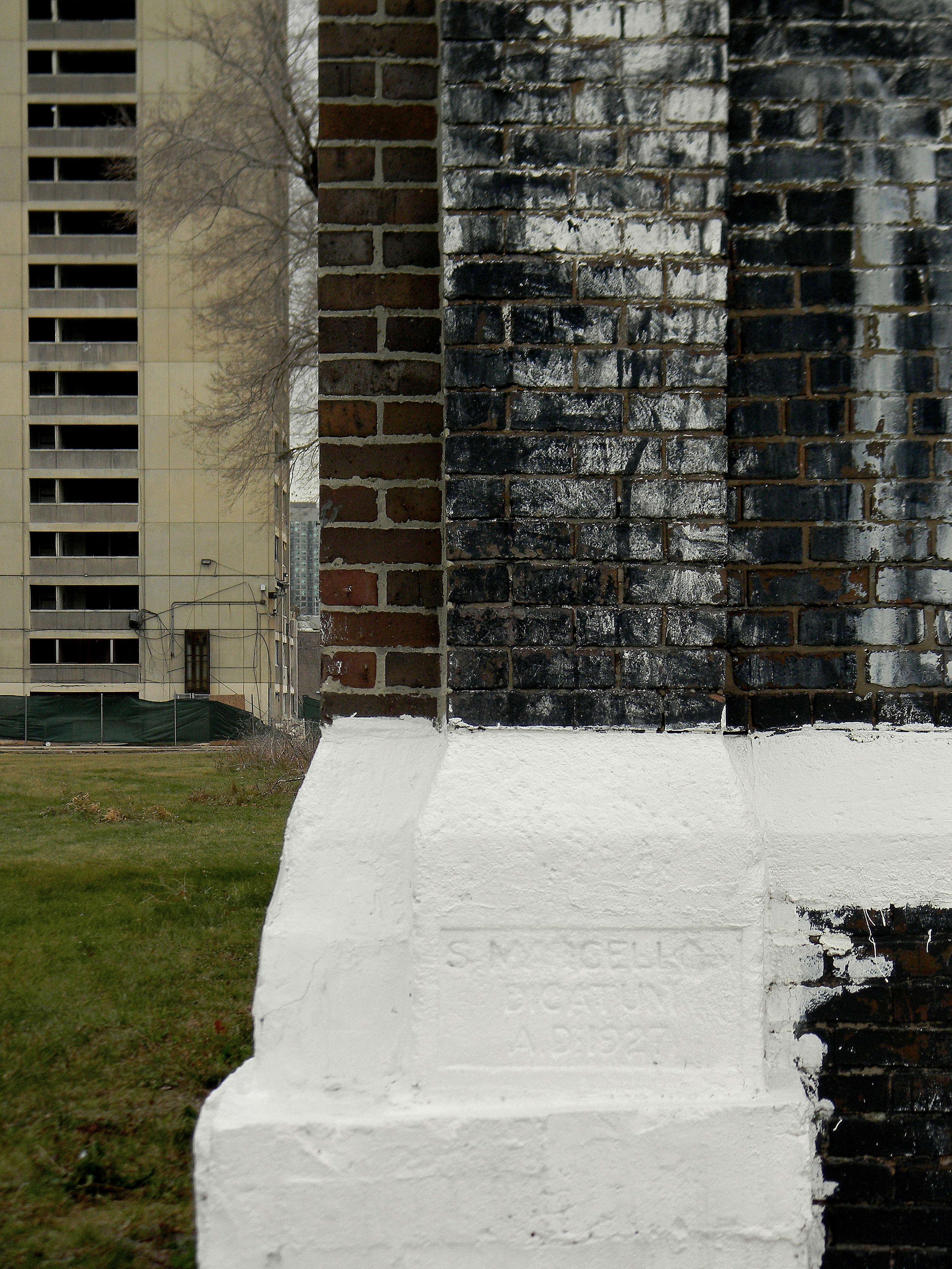
Cornerstone for former San Marcello Mission, dedicated 1927, with 1230 North Larrabee Street of the William Green Homes in background (November 2010). Gabriel X. Michael/Chicago Patterns
Originally built in 1901 as the Saint John the Evangelist Episcopal Church, in 1927, Saint Philip Benizi Catholic Church purchased and rededicated this church as the San Marcello Mission.
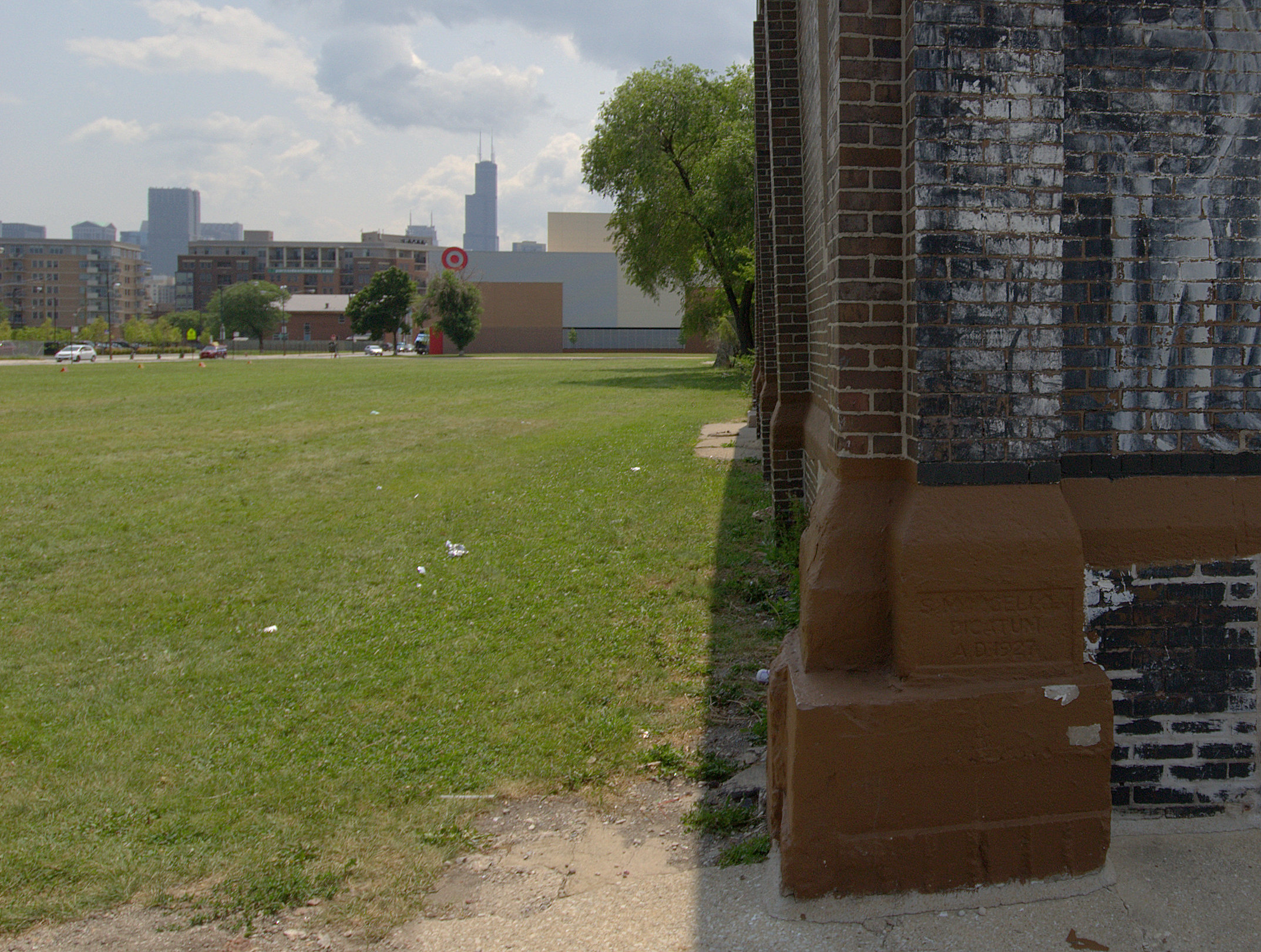
Northeast corner, cornerstone for former San Marcello Mission, dedicated 1927, with recently-constructed Target store and Parkside of Old Town developments in background (July 2014). Gabriel X. Michael/Chicago Patterns
Its cornerstone reads, “S. Marcello, Dicatum, A.D. 1927” which translates to “San Marcello, dedicated 1927 A.D.” The mission was established here until 1974 when the building became the home of the Northside Strangers’ Home MB Church.
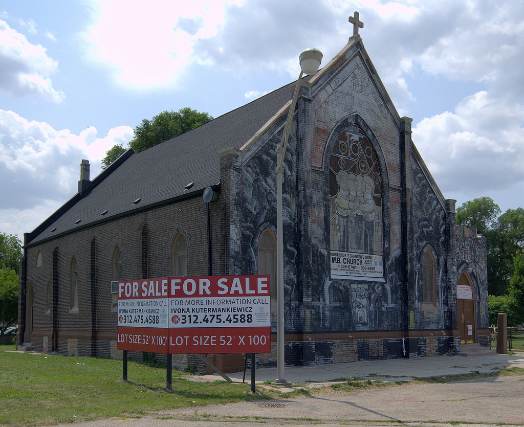
View of the former San Marcello Church, dedicated 1927, now Strangers’ Home MB Church and for sale, 617 West Evergreen Avenue. Gabriel X. Michael/Chicago Patterns
At the same time, pioneering public street artist William Walker was commissioned by the leader of San Marcello to create a socially-conscious mural, depicting the multi-ethnic makeup of the area and themes of social justice, peace, and harmony.
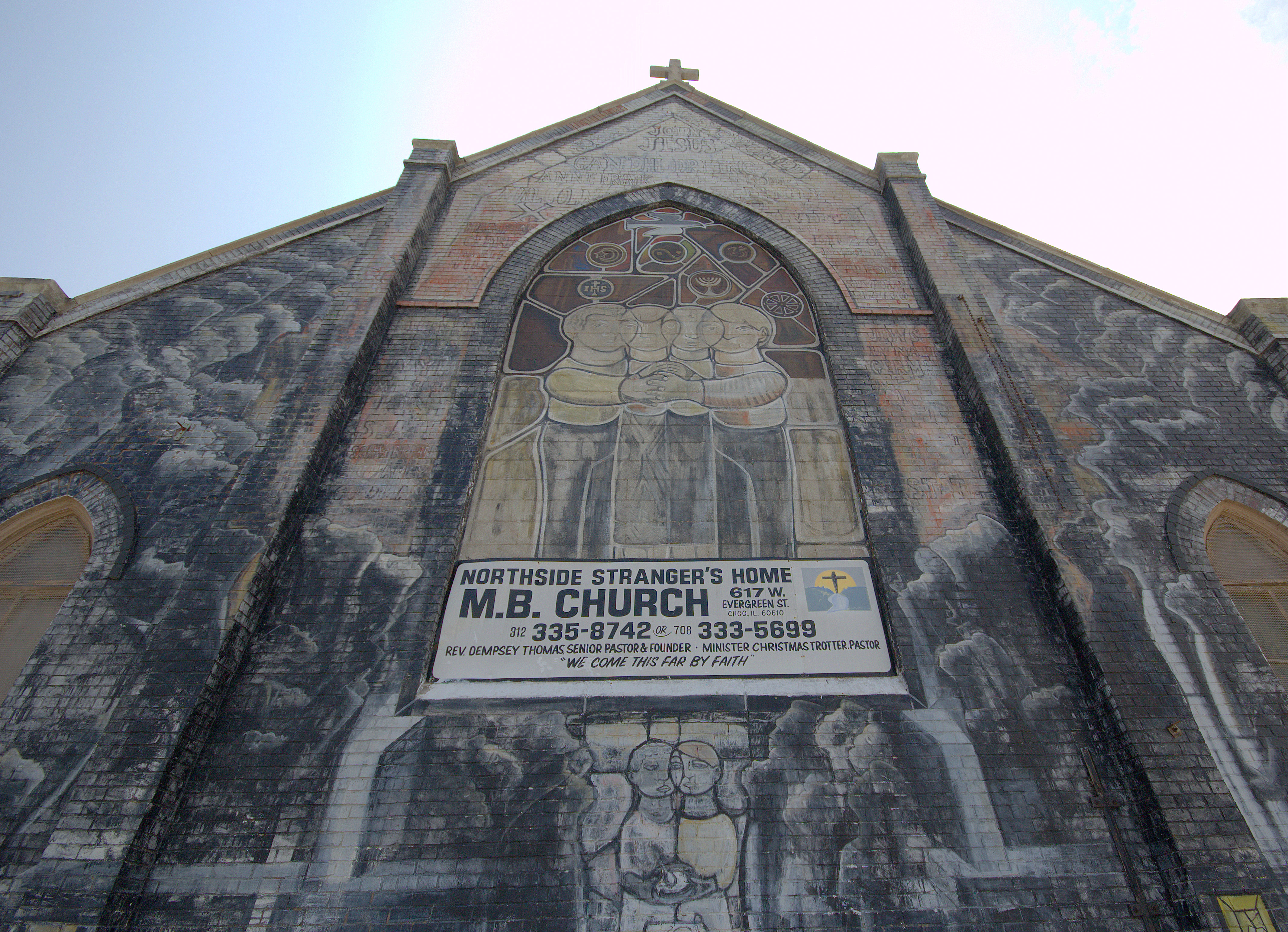
Detail of north facade of Strangers’ Home MB Church and the 1974 William Walker mural. Gabriel X. Michael/Chicago Patterns
The mural still survives as only one of three remaining Walker murals in the city of Chicago. Now recently listed (again) for sale, at $1.7 million this time, the fate of the church and its historic mural is unknown and seems especially vulnerable, given the acceleration of upscale development in this historically “poor” area of Chicago.
References and Further Reading
- The Gold Coast and the Slum
- “A Brief History of Chicago’s Little Sicily Neighborhood and the Saint Philip Benizi Parish”
- William Walker’s “All Of Mankind”, via Chicago Public Art Group
- 956 North Larrabee Street demolition permit, via Licensed Chicago Contractors
Thanks for a great piece. I lived on Larrabee for awhile and watched the neighborhood go through a couple of its nine lives. Your photos and story bring back good memories. I hope a couple of the old buildings survive.
Sincere thanks for reading and for your comments, David!
Thanks for great bit of history my mother’s side all lived on Larrabee St. My grandparents were immigrants from Altavilla Milicia, Sicily so they settled there and all the kids grew up attending St. Philip school (family name Dugo). After my father’s oldest brother was ordained he was assigned to St. Dominic and later he was made the pastor of San Marcello (family name PerciaBosco/Bosco). So the content in this post provided familiarity of things my parents shared with me when I was growing up in the 50’s. Thanks for posting. Gary Bosco
i made my first communion at st Marcellus church, now known as M B. The art work is awesome. I hope it will not be torn down.
San Marcello Church was a joint mission of two nearby Episcopal parishes, Church of the Ascension ( On LaSalle Drive and Saint James Church ( now the Cathedral of Saint James at Wabash & Huron. I am an historian and formerly served on the History commission of the Episcopal Diocese of Chicago. I am a former longtime resident of Chicago…
Great bit of information. My Italian side (Bartoli) moved to the same St. in the mid 20’s from Morris IL after my great grandfather died and my great grandmother must of know someone in Chicago on the St.to move there. The church is currently Larrabee and Evergreen but Evergreen used to be called Rees St. Prior to 1938 and later Evergreen. I drove my grandfather back before he passed in the early 2000’s and he was a little confused because of the housing projects that were there. The only thing he could remember is the old San Marcello Church. He said I used to live on this st. now Evergreen but cut off. I would love to see a picture of the old Rees St. from back in the day. I wonder if the Church which is now closed has an archive.
Thanks so much for all the information you provided. I am doing a family research and My husbands families, both sides, are from Sicily and settled on Cambridge street when first coming to the US. I was told that Saint Philip Benizi Church was their church at the time. These images are helpful to us in seeing what is left of that neighborhood. We have some old images from the 1940’s of a St Joseph Day procession down Cambridge Ave.
I was born at 1324 N.Sedgwick street in 1931.We latter moved to 448 W. Evergreen Street . My family had a Grocery and meat market on the South East coner of Evergreen St. and Cleveland Ave. In the Summer we could not wait for the Fiest of St. Joseph that was held South of Division stree near St. Phillips Benizi church. Thanks fot the memory. Dominic Fichera
In 1900 my Swedish great grandparents own a home in this neighborhood, my grandpa and brother were 6 and 4. I was surprised to find out they live where there was so much crime.
I also lived near near your family candy store in the early 50’s. I we to Mainers grammar school, lived on 1301 N Cleveland in the 50’s. I remember running up the stairs into the store and buying Hostess Snow ball cakes and or ice cream, popsicles on blue flavor. Many wonderful memories of our neighborhood. Thank you for listening.