Viewing all posts from the Garfield Park neighborhood
 Gabriel X. Michael
February 4, 2015
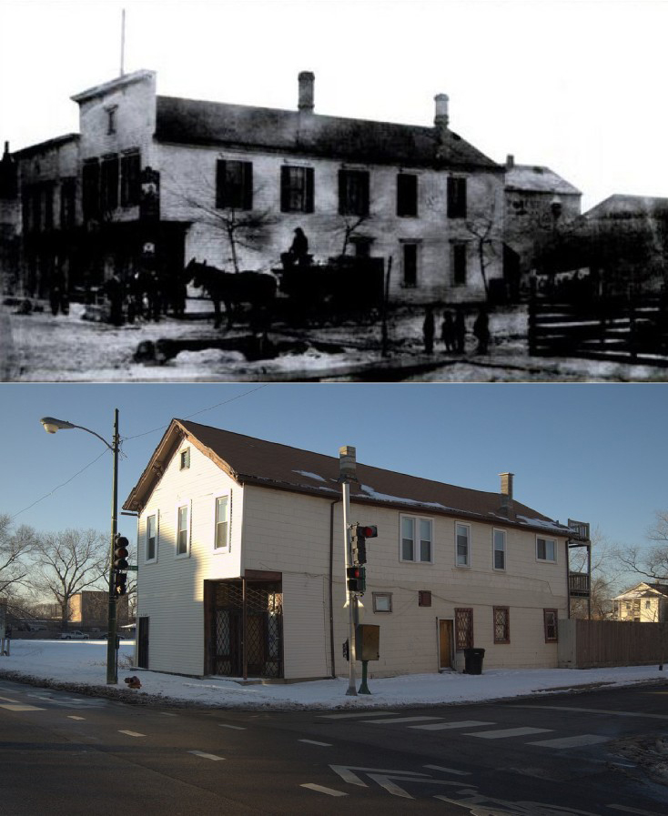
4200 W. Lake Street: formerly the Best Beer tied house/tavern circa 1883 (top image: p. 49, Lost German Chicago, Arcadia Publishing), currently a residential building. (bottom image by Gabriel X. Michael/Chicago Patterns)
Built in 1883, the two-story frame building at 4200 West Lake Street has undergone several transformations, just like the surrounding West Garfield Park community area. Pre-dating the Lake Street Elevated Railroad (now the CTA Green Line Lake Branch), it originally served as a “tied house” or tavern controlled by the Milwaukee-based Best Beer Brewing Company.
Continue reading »
Gabriel X. Michael
September 3, 2014

Gabriel X. Michael/Chicago Patterns
Before Edward Brennan developed the comprehensive 8 blocks-to-a-mile address system in 1909, Chicago street addresses were disorganized and confusing, being based on three distinct divisions of the city created by its surrounding waterways of the Chicago River, its branches, and Lake Michigan. Lake Street (the first street platted in the village of Chicago) was the city’s original dividing line between north and south but east and west designations depended on which side of the Chicago River and Lake Michigan you were located. Continue reading »
Gabriel X. Michael
July 17, 2014
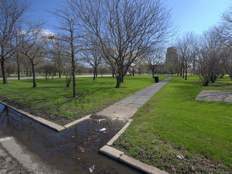
View of original northwest corner of Sacramento Square, now part of the West Town Academy, from the Sacramento Boulevard east service drive. Gabriel X. Michael/Chicago Patterns
Sacramento Square
This square is situated at an important transition point in the Chicago boulevard system, where Humboldt Park’s Sacramento Boulevard to the north connects into Garfield Park to the west via Franklin Boulevard. There is little green space at this turning point for the boulevard system, historically overrun by intersecting roadways and industrial traffic. It only retains one of its original corners, the southwest at Whipple Street and the Franklin Boulevard south service drive, and has some nondescript, while pleasantly shady, clusters of trees and shrubs.
Continue reading »
Gabriel X. Michael
July 16, 2014
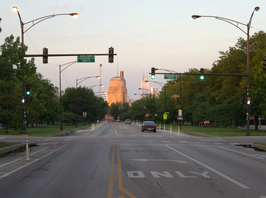
Viewing east on Franklin Boulevard from Kedzie Avenue, with Sacramento Square in the background. Gabriel X. Michael/Chicago Patterns
Chicago’s “Emerald Necklace,” our citywide boulevard system, was established in 1869 when the state legislature created governmental organizations to manage the development and maintenance of Chicago’s desperately needed new parks. One of these, the West Side Park System, was organized to create parks on Chicago’s farmland borders (presently west of Western Avenue) to spur middle- to upper-class residential development migrating out from the city center, and serve its growing inner-city population with recreational “pleasure grounds.”
Continue reading »